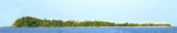
Pulau Mubut Laut and Mubut Darat, about 0.5 mile W, lie about 3.7 miles N of the W end of Pulau Karasbesar. Pulau Mubut Laut is 56m high and inhabited; it is the larger and higher of the two islands, and easily distinguished by its prominent position. It rises to a round peak, with the greatest slope on the E side, while Mubut Darat is considerably lower toward its center and thickly wooded.
The Selanga Islets, three in number, lying on the SE of Selat Pengelap, are small but elevated and conspicuous; the S islet is 35m high. With an opposing wind and current, a troublesome sea may arise in this area.The Pangelap group of islands separates Selat Pangelap from Selat Abang. ...
Pulau Karas Br, lying about 4 miles N of Korek Rapat, is 3.5 miles long and about 0.7 mile wide; it is hilly, with a flat summit, wooded, and has a reef encircling it extending in places for a distance of 0.25 mile.Pulau Karas-Ketjil (Karas-Kecil), an island marking the SW end of ...
The Merodong group of islands lie to the W of Pulau Mesanak, between it and the Temiang group. The former group comprises six islands, separated by channels unsuitable for navigation and there is no reason in venturing among them or between them and Pulau Mesanak. Merodong, the ...
Pulau Pangkil, attaining an elevation of 48m, is about 2 miles in length in a N and S direction and 0.5 mile in breadth; it is hilly, wooded, and lies on the E side of the main channel of Selat Riau, abreast Pulau Mubut Laut. It is surrounded by a reef which extends from 0.25 to ...
Pulau Pelanduk Subang Mas lies about 2 miles NW of Pulau Cemara.Pulau Airradja (Airaja), lies close N and is separated by a narrow drying channel at LW. It is the northernmost of the islands lying between Pulau Cemara and the E entrance of Selat Bulan.Both these islands are hilly ...
Pulau Telan (Telang), the SW point of which forms the SE limit of Selat Riau, is irregularly shaped and nearly 5 miles long, NE and SW, and about 1 mile wide. It is divided into two parts and may be identified by a square hillock on its S end, 63m high, which, with a sharper peak ...


 Pulau Mubut Laut and Mubut Darat, about 0.5 mile W, lie about 3.7 miles N of the W end of Pulau Karasbesar.