Le Cap d'Ail marque la séparation entre les baies de Beaulieu et de Monaco. Les abords étant malsains, il faut s'en écarter assez largement. Le cap Martin est couvert de pins d'où émerge un sémaphore blanc sur les hauteurs.
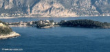
The Presqu'ile de Saint Hospice , 40m high, forms a peninsula which extends E from the center of the E side of the Cap Ferrat promontory. It is surmounted by a chapel and a conspicuous tower Pointe Saint Hospice, located 1.2 miles NE of the Cap Ferrat Light, is the E extremity of ...
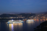
Rade de Villefranche is entered between Pointe des Sans Culottes, the SE extremity of the Mont Boron promontory, and Pointe Malalongue, the SW extremity of Cap Ferrat, 1 mile SE. The bay extends N for 1.5 miles and offers sheltered anchorage to vessels of any size. It is used by vessels ...
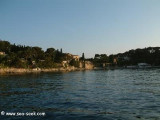
A l'Est du Cap Ferrat, deux anses offrent un mouillage alternatif à la traditionelle rade de Villefranche. Sur la gauche l'anse de Lilong et à droite l'anse des Fosses permettent de mouiller par 5m de fond. Ce sont des abris de beau temps bien ouvert sur le large. 2006-08-01 Bearing:20°


 canal 9


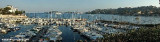
 Small harbour sheltered from all winds.
 Petit port abrité de tous les vents.
 Porticciolo abritato dei tuti venti.