Localisation
Port De Lome
| Latitude | Longitude |
| DMS | --- | --- |
| DM | --- | --- |
| DD | --- | --- |
Description

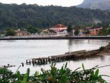
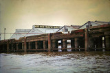
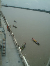
Small port protected by a breakwater.
2012/01/21
Update
mdenaclara

Petit port protégé par une digue.
2012/01/21
Update
mdenaclara

2012-01-21
Update
mdenaclara
Ebook | Gulf of Guinea- 18 sites
- 9 photos
- publication date: 5 Aug 2024
- .pdf file size: 6 Mb
|
Share your comments or photos on "Port De Lome"
Sites around Port De Lome
Flying distances - Direct line
Cotonou
Port protected by a breakwater.Tema
Port protected by a breakwater.Sekondi
Small port protected by a breakwater.Takoradi
Harbor protected by a breakwater.