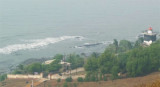
Worli Point (W India)
5.8nm
346°
A conspicuous TV ...
1 Mar 12
Jojo
| Latitude | Longitude | |
| DMS | --- | --- |
| DM | --- | --- |
| DD | --- | --- |
 mumbai
 Depths in the approach to the coast between Mumbai (Bombay) and Cape Rama are fairly deep and clear of dangers, with the exception of Angria Bank.
Angria Bank, with a least depth of 20.1m in position 16°43'N, 72°03'E, lies about 65 miles off the coast, and is composed of sand, shells, and coral. The bank is steep-to on all sides, with great depths surrounding it. The tidal currents set NE across the bank during the flood and SW with the ebb, with a velocity of about 1 knot in spring tides.
A volcanic disturbance was reported observed (1949) in an area about 100 miles SW of Angria Bank. Vessels should approach this area with caution.
Caution.—Between Khanderi Island and Boria Point, about 80 miles SSE, fishing stakes and logs are liable to be encountered in depths up to 22m.
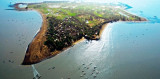
The city of Mumbai (Bombay), on Mumbai Island (Bombay Island), is the largest city of India and the principal seaport on its W coast.
Mumbai Harbor (Bombay Harbor) lies between Mumbai Island (Bombay Island) and Trombay Island to W and N, and Karanja Island and the mainland to E and S. It is the only natural deep-water port on the W coast of India. The harbor contains several islands, rocks, and shoals, with numerous bays and inlets indenting its shores.
The direction and management of the port, including pilotage, berthing, docking, and wharves, are administered by the Mumbai Port Trust. The daily operations of the port are carried out by the Chairman and Deputy Chairman.
The facilities of the port are mainly on the E side of Mumbai Island (Bombay Island). There are also tanker terminals at Pir Pau (Butcher Island) and at Jawahar Dweep (Trombay Island).
Visibility may be reduced by heavy rain during the Southwest Monsoon. A smoky haze frequently hangs over the area from November to March, mostly during the early morning and occasionally in the evening.
The tidal rise for Mumbai Harbor (Bombay Harbor) is 4.4m at MHWS and 3.3m at MHWN.
The velocity and direction of the tidal currents in the approaches to Mumbai (Bombay) are generally as described below, but they are greatly influenced by winds and heavy rains.
The tide does not set fairly through the channel, but the flood sweeps E over the foul ground of Thal Shoal. During rains in the Southwest Monsoon the ebb sets strongly W out of Dharamtar Creek.
The velocity of strong spring tides between Thal Shoal and Prongs Reef (18°53'N., 72°48'E.) is from 2.5 to 3 knots and perhaps as much as 4 knots during the rains.
Between Thal Shoal and a position about 4 miles WNW, the flood current sets between ESE and ENE, resulting in a more N direction as the velocity increases. In East Channel Swatch, E of Thal Shoal, it sets about NNE, taking a more E direction as it crosses the mouth of Dharamtar Creek.
Off the SW extremity of Prongs Reef, the flood current at first sets ESE and, as the velocity increases, shifts to the NE.
East of Prongs Reef, as far as Sunk Rock, it sets between NNE and NE.
On the S side of the harbor entrance the ebb current starts setting WSW across the mouth of Dharamtar Creek, changing to SSW upon the vessel’s approach to Thal Shoal, then more S as a vessel continues S.
From Thal Shoal extending WNW across the dredged approach channel to a position about 4 miles away, the current sets about SW.
On the N side of the harbor entrance, the current ebbs SW going from Sunk Rock until passing abeam Prongs Light, where it changes to W, then becoming SSW as the tide strengthens.
The velocity and direction of the tidal currents within Mumbai Harbor (Bombay Harbor) are generally as described below, but can also be greatly influenced by winds and heavy rains.
Tidal currents within Mumbai Harbor (Bombay Harbor) have velocities that range between 0.75 knot and 3 knots.
On the E side of the harbor, the flood current sets NE abeam Karanja Island, turning more ENE upon passing Karanja Beacon.
The current sets N between Butcher Island and Elephanta Island, then NE approaching Trombay Island.
On the W side of the harbor, from Sunk Rock to Cross Island, the flood current sets NNE, with a velocity of about 2 knots. The flood current splits N of Tucker Beacon (18°58'N., 72°51'E.), setting N until abeam Mazagaon Pier, then turning NE and ENE, joining the current from the E side of the harbor N of Butcher Island.
On the E side of the harbor, the ebb current sets SW in the channel between Butcher Island and Elephanta Island, continuing out of the harbor past Karanja Island, then turning WSW upon passing abeam the entrance Dharamtar Creek.
On the W side of the harbor, from Cross Island to inside Middle Ground Islet, the ebb current sets SSW, and then to Sunk Rock in a SW direction. From Cross Island to E of Middle Ground Islet, in mid-channel, the ebb current sets from SW to SSW; from there to Sunk Rock it sets SW, but at the first of the ebb the set is more W.
The ebb current on the W side of the harbor occurs 30 to 35 minutes earlier than on the E side, and during strong spring tides it can begin 40 minutes to 1 hour sooner.
From Trombay Island until passing abeam Mazagaon Pier the current ebbs SW.
Inshore and near the Indira Dock wall, during the Southwest Monsoon, the ebb current occurs about 45 minutes before the time of HW at Mumbai. This is important for vessels docking.
The ebb current sets SSW from abeam Cross Island until passing between Middle Ground Island and South Breakwater, whereas the ebb sets more S to SSW across the dredged channel and waters E of Middle Ground Island.
From Middle Ground Island to Sunk Rock, the ebb current sets between S and SSW, but at the start of the ebb the set is more W flowing.
The flood current in the vicinity of the tidal basin and wet docks runs parallel to the South Breakwater, then ENE past the entrance to the tidal basin, joining the main flood current setting N passing E of Middle Ground Island.
An eddy current flows S along the E side of Ballard Pier, then turns W into the tidal basin. This eddy current also flows close E to the head of South Breakwater before turning SW alongside the breakwater. The effects of this eddy have been observed up to 100m E of the SE extension of Ballard Pier.
Both the flood and eddy currents run strongly past the head of the South Breakwater, causing ships to sheer violently in this area.
Mumbai Harbor (Bombay Harbor) is approached through a series of dredged channels commencing about 4 miles SW of Prongs Reef Light. The initial depth is dredged to 11.1m for about 2 miles heading, then to 11m for about another 2 miles, then to 10.9m continuing into the harbor entrance to a point about 1.3 miles ENE of Middle Ground Island, then to 10.8m until the main channel, marked by range lights in line bearing 085°. The main channel continues S then SE of Elephanta Island, then passing NE of Jawaharlal Nehru
Port, and has a maintained depth of 11m. At the point where the main channel starts there is another dredged channel, with range lights in line bearing 202.7°, continuing NNE between Butcher Island and Elephanta Island, to about 18°58'N, then with a depth of 8.7m into Trombay Channel.
Mariners should navigate with caution through these maintained channels since they are subject to silting, especially during times of strong monsoon winds. For latest information concerning maintained depths of these channel, mariners should contact the Mumbai Port Authority.
The maximum drafts for alongside berths are subject to change due to siltation and dredging. The Port Authority at Mumbai should be contacted to determine the maximum allowable draft at any specific time, as well as any possible restrictions on berthing or departures during night hours.
The three enclosed wet docks in the harbor are named Indira, Victoria, and Prince’s. In addition to these wet docks, there are also, along the harbor front, many “bundars,” which are open wharves and basins that have extensive facilities for the working and storage of many different types of cargo.
Further information on these areas is, as follows:
1. Indira Dock is entered through an entrance lock, 228m in length and 30.5m in width. The entrance lock is located close NNW of Ballard Pier.
Hughes Drydock is entered from Indira Dock. It can accommodate vessels up to a maximum length of 304m, and 30.4m in width. The pumps in Hughes Drydock have been electrified and are capable of increasing the water level to 10.5m at all berths within Indira Dock at any time.
Ballard Pier is the continuation of the W side of Indira Dock entrance lock and is the main terminal for passenger vessels. The N part of the pier is for container vessel accommodation.
2. Victoria Dock is entered through a swinging lock gate from the E side for vessels with a maximum width of 16.76m. The maximum loa for vessels during the day is 152m and only 122m during the night. The maximum entry draft is 6.7m at all times.
There is a channel connecting this dock with Prince’s Dock that is 19.5m in width close N from the entrance.
3. Prince’s Dock is entered through a swinging lock gate with an entrance width of 20m and a dredged channel depth of 6.6m. The maximum width for a ship that can enter Prince’s Dock is 13.8m.
Ships can be taken into Prince’s Dock only from about 2 hours 45 minutes before the time of HW to 30 minutes after the time of HW. They cannot leave the dock after the time of HW because the ebb current commences in that vicinity about 90 minutes before the time of HW and sets directly down on to the reef N of Cross Island at about the time of HW.
There is a channel connecting this dock with Victoria Dock that is 19.5m in width close S from the entrance to Prince’s Dock.
General berthing information for the wet docks plus the deepwater petroleum and crude oil facilities at Butcher Island and Pir Pau in Trombay Channel are given in the accompanying table titled Mumbai (Bombay)—Berthing Facilities.
In Jawahar Dweep, loaded tankers are berthed at HW and two tugs are required to assist. It is compulsory to test astern power during the approach and before berthing at the terminal.
There is a turning circle, best shown on the chart, found close E of Berth JD-4.
Jawaharlal Nehru Port (Nhava Seva) is a separate port in the E part of Mumbai Harbor (Bombay Harbor) on the mainland SE of Elephanta Island. The facility is administered by a separate port authority from Mumbai (Bombay). The port provides container berths, bulk cargo berths, and bulk liquid berths accommodating vessels to 80,000 dwt, a ship repairyard, and a linkspan for ro-ro traffic.
 (W India)")
In the immediate approach to the harbor, within the area shown by dashed lines on the charts, no fishing stakes are permitted, but even within this area they are sometimes placed, and so may be encountered before the port authorities have been able to remove them. Occasionally the heads of the stakes are broken off at the waterline.and then they may not be seen above water.
All fishing stakes are normally removed each year for the duration of the Southwest Monsoon.
Numerous wrecks, best seen on chart, lie in the approaches, channels, and adjacent waters of the port of Mumbai (Bombay). Mariners should use caution while transiting these waters.
Numerous small fishing vessels, with buoyed nets, are likely to be encountered up to 25 miles offshore from Mumbai (Bombay).
A depth of 23m was reported in 1987 close W of the 200m depth contour in approximate position 19°00'N, 69°55'E.
Mariners are advised not to anchor or fish near the pipelines to avoid damaging them.
Submarine oil and gas pipelines are laid from the SW point of Karanja Island, WSW through the entrance to Mumbai (Bombay) Harbor and then NW to Mumbai (Bombay) High Field.
 (W India)")
 (W India)")
Ebook | Arabian Sea
|