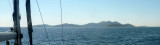
Vrgadski Kanal
3.2nm
161°
Vessels with a maximum draft of 6.4m may pass through Pasmanski Kanal. Vessels with drafts over 6.4m must either proceed through ...
16 Jul 11
Jojo
| Latitude | Longitude | |
| DMS | --- | --- |
| DM | --- | --- |
| DD | --- | --- |


 Bonne tenue
 douche sur la plage
 sur la route
 centre médical village
 village
 marché village
 village
 village
 village


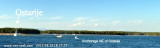
Pakostane is a small tourist town in front of which there are three small islands (Justina, Skolk, Babuljas) only a few tens of meters from shore. It is situated between Lake Vrana and the Adriatic Sea.
Approach: the best approach to the N becomes E Babuljas Island, which is a chapel. Attention, a shoal (bollard) beyond the island to the NE.
Funds are low between the island and the island Skolk.
Can moor at the dock or anchor in the NE of the island furthest to the W by 5-8 m.
No good wind protection whatsoever.


 Pakostane est une petite ville touristique en face de laquelle se trouvent trois petites îles (Justina, Skolk, Babuljas) à seulement quelques dizaines de mètres du rivage. Elle est située entre le lac de Vrana et la mer Adriatique.
Approche: la meilleure approche passe au N de l'île Justina, qui porte une chapelle. Attention, un haut-fond (bollard) déborde l'île au NE, le contourner par le nord.
Les fonds sont faibles entre cette île et l'île Skolk.
Ne pas approcher le port par le NW.
On peut s'amarrer au quai ou mouiller dans le NE de l'île la plus à l'W par 5 à 8 m.
Pas de bonne protection du vent quel qu'il soit.
 Pass it to the North.
 Old port.
Ebook | Zadarska županija (Zadar county)
|
Ebook | Dalmacija (Dalmatie)
|