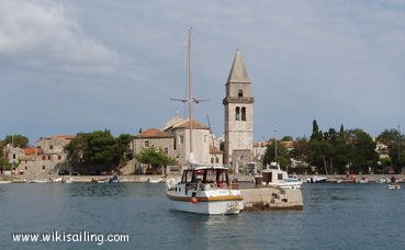
Luka Osor (Cres)

Luka Osor (Cres)

To precisely geolocate this site. Update if necessary.

Localisation

Characteristics

Port
Mud
Mooring
Water robinet près de la route

Description

Luka Osor (Cres)
2008-07-15
Update
Luka Osor (Cres)
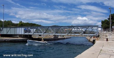
Le pont d'Osor
2008-07-15
Update
Located where the islands of Cres and Losinj are separated only by a narrow channel (Kanal Losinjski) spanned by a swing bridge low-rise, which opens two times daily, at 9 am and 17 pm
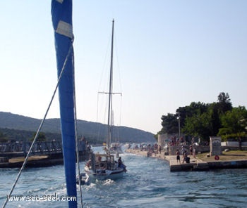
Access is not recommended by Bora or Sirocco strong.
You can anchor and take a line ashore in the small bay of Uvala Bijar, N of Osor. The funds are too high and steep that it wets only its anchor.
Do not tighten too close to the point N (fire) to avoid a rock spur.
It is possible to moor along the quay in the N input N channel. There are more than 3 m of water.
It is possible to anchor the S at the edge of the channel or anchor and take a line on the wedge launch.
Protected from all winds. The dock N of the channel is exposed to winds from the N and NW. The locations of the S channel are exposed to wind and the sea of ​​SE.
2011/08/3
Update
Jojo
Luka Osor (Cres)
2011-08-03
Update
Jojo
Situé à l'endroit où les îles de Cres et de Losinj ne sont séparées que par un étroit canal (Losinjski Kanal) enjambé par un pont tournant de faible hauteur, qui s'ouvre 2 fois par jour, à 9h et à 17 h.

L'accès est déconseillé par Bora ou Sirocco forts.

On peut mouiller en portant une amarre à terre dans la petite baie d'Uvala Bijar, au N d'Osor. Les fonds sont trop importants et pentus pour que l'on mouille seulement sur son ancre.

Il ne faut pas serrer de trop près la pointe N (feu) pour éviter une avancée rocheuse.

Il est possible de s'amarrer le long du quai N dans l'entrée au N du canal. Il y a plus de 3 m d'eau.
Il est possible de mouiller au S, au bord du chenal ou de mouiller en portant une amarre sur la cale de mise à l'eau.

Protégé de tous les vents. Le quai au N du canal est exposé aux vents du N et NW. Les emplacements au S du canal sont exposés au vent et à la mer de SE.
2011/08/2
Update
Jojo
Ebook

Kvarner

  • 120 sites
  • 182 photos
  • publication date: 7 Jul 2023
  • .pdf file size: 69 Mb
Share your comments or photos on "Luka Osor (Cres)"

Sites around Luka Osor (Cres)

Flying distances - Direct line

Otok Unije

6.3nm
241°
Otok Unije, a long and irregular shaped island, lies with Rt Vnetak, its SW extremity, located 7 miles NNW of Otok Susak and at W from N O. Losinj from it is separated by Unijski Kanal.
The island consists of a chain of partly wooded hills and the summit, 132m high, stands in the ...
31 Jul 11
Jojo

Medulinski Zaljev

20nm
287°
This area is located between Cape Kamenjak SW Marler and heading to the N.
Seven small islands surrounded by rocks and shoals dot the entrance Medulinski Zaljev.
Four tags indicate isolated rocks in the W of the bay, their presence is uncertain.The chanel between Rt Munat et ...
26 Mar 11
Joëlle

Olipski Kanal

23nm
141°
Olipski Kanal leads NNW between the E side of Otok Silba and the W side of Otok Olib and merges into the N end of Pohlipski Kanal.
This channel is deep and has a minimum navigable width of 0.7 mile. It is often used by vessels proceeding to and from Zadar.
Good anchorage is ...
18 Sep 11
Jojo

Otok Plavnik Kvarner

17nm
19°
Otok Plavnik lies with Rt Veli Pin, its N extremity, located 0.7 mile E of the E side of Otok Cres and divides Srednja Vrata in its S part into two channels.
This cliffy island is 194m high and partly wooded.
Several small islets lie on a shoal bank which extends about 1.5 miles ...
4 Aug 11
Jojo

Kanal Vela Vrata

27nm
348°
Kanal Vela Vrata connects the N end of Kvarner to Rijecki Zaliv and leads between the N end of Otok Cres, on the E side, and the mainland coast, on the W side.
The channel is deep and clear, the bottom being formed of mud.
31 Jul 11
Jojo

Otok Olib Zadar

24nm
138°
Otok Olib is located E of O. Silba. It belongs to Zadar archipelago.The island has been inhabited since Roman times. The residents bought their island in 1900. The only village on the island was established around the port.
To the east of the island you will find some small hidden ...
27 Jul 11
Jojo