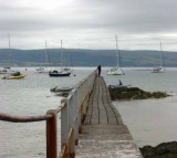
The inner harbour marina (accessible at approximately high water +/- 2 hours) is the main area for visiting leisure craft to berth but there are also berths in the outer harbour which are less dependent on the tides. A summer only pontoon is available for short periods at all states ...
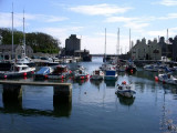
Castletown is a heritage harbour consisting of outer and inner drying harbours. It is mainly used by inshore fishing vessels, local and visiting pleasure craft and occasional coasters. Berths available Moorings: One white can type mooring buoy is situated 3 cables SE of the Breakwater ...


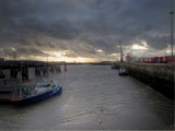


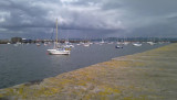
 Small port protected by a breakwater.
 Petit port protégé par une digue.