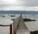
The inner harbour marina (accessible at approximately high water +/- 2 hours) is the main area for visiting leisure craft to berth but there are also berths in the outer harbour which are less dependent on the tides. A summer only pontoon is available for short periods at all states of tide at the Battery Pier (by No. 14 Berth) A slipway for the launching of small craft at all tidal states is situated next to the Fort Anne Jetty. Entry to the Harbour is gained from the N.E. (heading 229) by leading marks (white opposing triangles) which are illuminated at night by flashing (occ 10s) white lights, now supplemented by red flashing opposing arrows. This approach will avoid possible overfalls at the end of the Breakwater The fairway is marked by two Starboard hand buoys (Q(3)G.5s) & (Fl.G3s) with, to Port, a concrete ?dolphin' (2F.red vert) which marks the end of the Breakwater. At the entrance, tides of up to 2 knots to the North East and South can be expected during flood and ebb tides respectively.
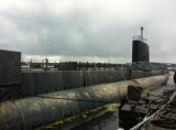
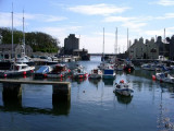
Castletown is a heritage harbour consisting of outer and inner drying harbours. It is mainly used by inshore fishing vessels, local and visiting pleasure craft and occasional coasters. Berths available Moorings: One white can type mooring buoy is situated 3 cables SE of the Breakwater ...


 next to the Inner Harbour Office
 The inner harbour marina (accessible at approximately high water +/- 2 hours) is the main area for visiting leisure craft to berth but there are also berths in the outer harbour which are less dependent on the tides. A summer only pontoon is available for short periods at all states of tide at the Battery Pier (by No. 14 Berth)
")