Fornæs LighthouseGrenaaAfter England War 1807-14 was the marking of the Danish coasts to a halt. In 1830 lighthouse inspector C.A. Leth responsible for the Danish lighthouse. And he spent 1838-1839 two new lighthouse construction, first lighthouse at Hirsholmen and then lighthouse ...
Revsnæs LighthouseWest of KalundborgRevsnæs lighthouse was built in 1844. After England 1807-14 war ships were increasingly way through the Great Belt and from the Baltics. Thereby avoiding the healthy to pay customs at Helsingør. In 1830 sent the 12 skippers in vain a letter to ...
Sletterhage LighthouseHelgenæsOn the soutwestern ornaments of Helgenæs is Sletterhage lighthouse. Located off the gulf of Århus, Århus Municipality had set up a lighthouse here already in 1872, and this lighthouse was taken over by Lighthouse-administration in ...
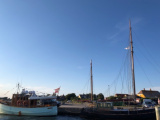
North-east of Samsøe Island, on the edge of the Stavnsfjord, is the small natural harbor of Langør. You can anchor in the bay to the east except in southerly winds.
Superb island with Danish-style bike rental (you pay yourself - bikes ready to use)Restaurant smoking house ...


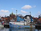
 Small port protected by a breakwater.
 Petit port protégé par une digue.