Ishulli i Sazanit , an island, lies 2.5 miles NNW of Kep i Karlovecit and attains a height of 331m. Two almost equally-elevated peaks are separated by a depression and give this island, from a distance, the appearance of being two islands. The W side of the island is formed by vertical ...
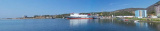
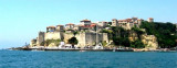
Ulcinj is the southernmost city at Montenegrin coast, 8.5 NM at the northern Albanian border formed by the river Bojama (or Lum Buena). This small town is walled and fortified. It stands in the form of an amphitheater and is conspicuous from seaward. The port is located in an open ...
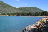
This large deep bay, at 3 M NW of Ulcinj, is open to the NW. It is surrounded by wooded hills rising to 389 m NE. Basically there is a beach lined with evergreens. The bay is a lighthouse on Rt Mendras, the tip S of the entrance. Is wetted by 4-7 m on the S side of the bay because ...
Porto San Nicolo , a small harbor, lies at the head of a bay on the NE side of the island. It is protected by breakwaters and has an entrance, 90m wide, with a depth of 4.5m. There is 209m of quayage, with depths of 1.8 to 5m alongside, which is used by small craft and coasters. As ...