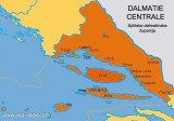

Splitsko-dalmatinska županija (Split-Dalmatia County)
17nm
200°
Split is situated on a peninsula between the part E of the Gulf of Kastela and the Split Channel.
The city is ...
4 Aug 11
Jojo
| Latitude | Longitude | |
| DMS | --- | --- |
| DM | --- | --- |
| DD | --- | --- |

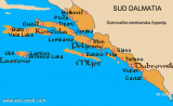
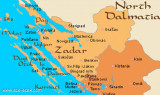
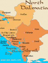
 Dalmatia (Croatian Dalmacija, Italian Dalmazzia) is a coastal region of Croatia along the Adriatic, stretching from the island of Pag in the northwest, the Bay of Kotor (Montenegro) to the south East.
")
 La Dalmatie (en croate Dalmacija, en italien Dalmazzia)est une région littorale de la Croatie, le long de la mer Adriatique, qui va de l'île de Pag, au nord-ouest, à la baie de Kotor (Monténégro) au sud-est.
Ebook | Dalmacija (Dalmatie)
|