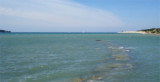
The marina entrance is difficult to see because of the quay. The anchor in the marina is not allowed. The marina is protected from all winds but the Mistral and Tramontana can cause a heavy swell. * T. 052/436661 * F. 052/436320 * Mail: marina.cervar @ plavalaguna.hr *259 B. (<25 m)
2011/03/21
Update
Joëlle
glicinija5 cervari
2014/10/22
Update
L'entrée de la marina est difficile à voir à cause du quai. Le mouillage dans la marina n'est pas autorisé. La marina est protégée de tous les vents mais le Mistral et la Tramontane peuvent provoquer une forte houle.
Koperski Zaliv (Baia di Capodistria) is entered between Rt Ronco and Rt Debeli, 5 miles NE.The NE and SW shores of the bay are hilly, but the shore at the head of the bay, through which the Fiume Risano flows, is low. Monte Sermino, surrounded by salt beds, rises isolated in the river ...
The Gulf of Piran or Piran Bay (Slovene: Piranski zaliv, Croatian: Piranski zaljev or Savudrijska vala, Italian: Baia di Pirano) is located in the northern part of the Adriatic Sea, and is a part of the Gulf of Trieste. It is between Rt Madona at N and Rt Saudrija. It was named ...
Warning: From Porec to the entrance to the Limski kanal there are a large number of dangerous shoals and rocks. On the N side of Funtana bay is the Janjci shoal, its northern edge is marked by a black post with two red bands and topped with two black spheres. At the southern ...
Limski Kana is entered between Rt Kriz, located 2.4 miles NW of Rovinj, and Rt Sjole, 1 mile NNW. The Lim bay and valley is a peculiar geographic feature found near Rovinj and Vrsar on the western coast of Istria, south of Porec, Croatia.The Lim valley is the 35 km long valley ...
From Rt Kriz (located S of Limski Kanal entrance), there are some shoals and islets. In front of Rt Muca are Figarola islet and Hr Figarolica at SW from it. Plic Muca, under 7/8 m of water, and Plic Skver, under 10 m of water, are off Rt Muca, NW of Uvala Valdenora, between Rt Muca ...
This large bay, located SW of Novigrad, between Cape Point and Meja Zub wearing a headlamp. Attention, from the N at high-tide "Plicina Val" marked by a buoy unlit face in Novigrad.


 canal 17


 The marina entrance is difficult to see because of the quay.
 L'entrée de la marina est difficile à voir à cause du quai.