Bahia Honda Key (Florida Keys)

Bahia Honda Key (Florida Keys)

To precisely geolocate this site. Update if necessary.

Localisation

Bahia Honda Key (Florida Keys)
LatitudeLongitude
DMS------
DM------
DD------

Characteristics

Coast

Description

Bahia Honda Key (Florida Keys)
2010-03-07
Update
Joëlle
Ebook

Gulf of Mexico

  • 227 sites
  • 182 photos
  • publication date: 9 Jul 2023
  • .pdf file size: 78 Mb
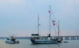
Bahia Honda (meaning deep bay, in Spanish) is an island in the lower Florida Keys.
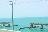
Bahia Honda State Park. Founded in 1961, occupies most of the island. The channel at the island's west end is one of the deepest natural channels in the Florida Keys.

Marine life is quite plentiful in the waters surrounding the island. Just off the beach snorkelers can spot many species of small reef fish, as well as rays, barracuda, and even the occasional small nurse shark.

The only known natural colony of the now rare Miami blue butterfly was discovered in the park in 1999. The butterfly had been thought to have become extinct as a result of Hurricane Andrew in 1992. Several rare plants, including yellow satinwood, silver palm (Coccothrinax argentata), key thatch palm (Thrinax morrisii), and the endangered small-flowered lily thorn (Catesbaea parviflora) are found in the park.

The park is also a part of the Great Florida Birding Trail. White sand beach was at one time named the best in the continental United States. There is also a tidal lagoon.

2012/04/16
Update
JB
Le parc d'État de Bahia Honda (Bahia Honda State Park) est une réserve naturelle située dans l'État de Floride, au SE des États-Unis, dans le comté de Monroe.
Bahia Honda est le nom d'une île appartenant à l'archipel des Keys. Le détroit qui se situe à l'W est l'un des plus profonds de l'archipel.

La flore est composée de palmiers (Coccothrinax) et d'autres plantes tropicales. La faune est diverse : Requin dormeur, Raie, Barracuda, poissons des récifs coralliens ; on y trouve par ailleurs l'une des rares colonies de Cyclargus thomasi bethunebakeri, un joli papillon bleu.
Le parc fait partie du Great Florida Birding Trail. Il offre aux visiteurs de belles plages de sable blanc et un lagon.

2012/04/16
Update
JB
Share your comments or photos on "Bahia Honda Key (Florida Keys)"

Sites around Bahia Honda Key (Florida Keys)

Flying distances - Direct line

Key Vaca (Florida Keys)

10nm
75°
Key Vaca is an island in the middle Florida
Keys, located entirely within the borders of the city of Marathon, Florida. It is often incorrectly identified as
"Marathon Key."Key Vaca is located between Fat
Deer Key and Knight's Key. Key Vaca is also connected via bridge to ...
22 Mar 10
Joëlle

Long Key (ou Rattlesnake key) (Florida Keys)

27nm
68°
Long Key was called Cayo Vivora (Rattlesnake Key) by early Spanish explorers, a reference to the shape of the island, which resembles a snake with its jaws open, rather than to its denizens.
In the early 20th century, Long
Key was the site of a luxurious fishing resort that ...
5 Apr 10
Joëlle

Bahia Honda Channel (Florida)

1.7nm
237°
Bahia Honda Channel is located between Spanish key and Bahia Honda westrly shores.
The anchorage is located  between the two Bahia Honda bridges.
Depth: 5 to 9 feet. open to southern, northern and northwesterly winds.
8 Mar 10
JB

Moser Channel (Florida Keys)

5.3nm
78°
Moser Channel, 36 miles E of Key West, affords passage between the keys from the Gulf of Mexico to Hawk Channel for vessels of 7 to 8 feet in draft. The swing span of Seven Mile Bridge across Moser Channel has been removed; however, the bridge piers remain. The fixed highway bridge ...
16 Apr 12
JB

Newfound Harbor Northely anchorage (Florida)

6.7nm
264°
Located between Torch Key and Big Pine Key, before the bridge that lie the two keys, the anchorage is depth of 6 feet.
Very good shelter except by strong southern winds.
8 Mar 10
Renée

Newfound Harbor Southerly anchorage (Florida)

7nm
252°
Newfound Harbor is located in the lower keys between Big Pine, the Torch Keys and
Ramrod Key.
We anchor in 7-9 feet of water on the West side of a small island called Picnic Island.
Open to Westerly winds.
8 Mar 10
Alain