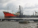

Sungaigerong
57nm
176°
27 Mar 12
BlodigGurkFan
| Latitude | Longitude | |
| DMS | --- | --- |
| DM | --- | --- |
| DD | --- | --- |

 The coast of Sumatera (Sumatra) from Batakarang Point trends NNW for about 65 miles to Tanjung Jabung.
Tanjung Batakarang was reported to have extended nearly 1 mile E of its charted position.
Ebook | Sumatra (Indonesia)
|


