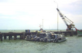

Pangkalan Oil Terminal (NE Sumatra)
Winds—WeatherThe weather is normally fair with moderate ...
| Latitude | Longitude | |
| DMS | --- | --- |
| DM | --- | --- |
| DD | --- | --- |

 Teluk Aru (Teluk Ara) is entered between Ujung Tamiang and Tanjung Bedukang about 21 miles SSE, is fronted by mud flats with the 2m contour line extending to almost 5 miles offshore.
Two islands, Pulau Kampai and Pulau Sembilan, lie on the N and S sides. Both islands are low but have tall trees which may be seen from a distance of about 16 miles.
The settlement of Kumpai stands on the S end of Pulau Kampai. Several small islands stand at the head of the bay. Tanjung Bedukang, the S entrance point of the bay, is difficult to identify.
There are three buoyed channels leading into Teluk Aru across shallow bars to rivers, waterways, and berths, as follows:
1. Alur Pelayaran Kampai leads to the river entrances on the W side of the bay. This channel has a least depth of 2.1m on the bar.
2. Alur Pelayaran Sembilan, the main channel, leads to the oil loading station at the Port of Pangkalonsusu. This channel is reported to have a least depth of 3m at the bar.
3. Alur Pelayaran Babalan leads to the oil-loading station at Pangkalanbrandan. The least depth in the channel is 0.6m on the bar.
Caution.—The buoyage of these channels is subject to alteration due to changes in the fairways.
A prohibited area extends W from Pulau Sembilan. A restricted area extends W from Pulau Sembilan across Alur Pelayaran Kumpai and SW to Panjang. Both areas are best seen on the chart.
Ebook | Sumatra (Indonesia)
|


