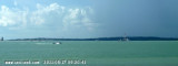
The Sungai Benut, entered about 8 miles N of Pulau Pisang, is the largest river along this part of the coast. Only small vessels with local knowledge can be accommodated.
Pulau Pisang (English: Banana island) is a small island located off the Western coast of the Malaysian state of Johor. It is about 12 km from the town of Pontian Kecil and 5 km from Benut town. It is the siteof Pisang Lighthouse guiding ships into the western entrance of the Singapore ...
Karimun Kecil or Little Karimun, separated from the NE side of Great Karimun by a deep channel about 0.5 mile wide, is a bold island, 377m high. In the NW approach to the channel between Great Karimun and Little Karimun are two islets, Nangoi, 39m high, about 1.2 miles W of the ...
Assan and Mudu, rocky and thickly-overgrown islands, 83 and 65m high, respectively, lie about 1.2 miles off the NW side of Great Karimun. Sajuda, an above-water rock, lies 0.5 mile N of Assan and Seal Rock lies about 0.5 mile NE of Sajuda. Tokong Belanda, a low rock, lies about ...
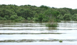
Located South-west of Johor, about 5,5 NM NW of Tg Piai, 1 km offshore from the quaint little fishing
village of Kampung Air Masin in Kukup Laut (Pontian District), Pulau
Kukup is an low, flat island entirely covered by mangrove forest and surrounded by
mudflats - the mudflats ...
Pulau Iyu Besar and Pulau Iyu Kecil, each 45m high, lie about 3 miles N of Little Karimun. Pulau Iyu Kecil lies 0.5 mile NE of Pulau Iyu Besar. The islets are known as The Brothers. A rock, with a depth of 2m, lies 0.3 mile NE of Pulau Iyu Kecil, and a rock, with a depth of ...


 The Sungai Benut, entered about 8 miles N of Pulau Pisang, is the largest river along this part of the coast. Only small vessels with local knowledge can be accommodated.
")