Pulau Dompak Basin and Sekaptap (Indonesia)

Pulau Dompak Basin and Sekaptap (Indonesia)

Per individuare con precisione. Aggiornare se necessario.

Localizzazione

Pulau Dompak Basin and Sekaptap (Indonesia)
LatitudeLongitude
DMS------
DM------
DD------

Caratteristica

Isola / Atoll
Relitto

Descrizione

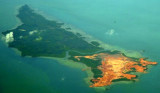
Pulau Dompak, 4 miles long and about 2 miles wide, is separated from the W coast of Pulau Bintan by Selat Dompak (Dompak Strait), a narrow channel only available to boats.

The land in the vicinity of the channel is quite hilly and surrounded with tall trees, as opposed to low land at the W extremity of the channel.

Dompak Village is situated at the E extremity of the channel near Tanjung Rambu. Dangerous wrecks, best seen on the chart, lie to seaward of this point.

Pulau Basing and Pulau Sekatap, two low and wooded islets, lie off the S shore of Pulau Dompak, both being on a reef; the former islet is inhabited.

2012/02/17
Aggiornare
Jojo
Ebook

Sumatra (Indonesia)

  • 326 sites
  • 109 photos
  • publication date: 6 Jul 2023
  • .pdf file size: 100 Mb
Condividi i tuoi commenti o le foto su "Pulau Dompak Basin and Sekaptap (Indonesia)"

Siti intorno a Pulau Dompak Basin and Sekaptap (Indonesia)

Flying distances - Direct line

Merodong group (Indonesia)

29nm
179°
The Merodong group of islands lie to the W of Pulau Mesanak, between it and the Temiang group. The former group comprises six islands, separated by channels unsuitable for navigation and there is no reason in venturing among them or between them and Pulau Mesanak.
Merodong, the ...
10 Feb 12
Jojo

Pulau Karas Besar and Karas Kecil (Indonesia)

10nm
220°
Pulau Karas Br, lying about 4 miles N of Korek Rapat, is 3.5 miles long and about 0.7 mile wide; it is hilly, with a flat summit, wooded, and has a reef encircling it extending in places for a distance of 0.25 mile.Pulau Karas-Ketjil (Karas-Kecil), an island marking the SW end of ...
14 Feb 12
Jojo

Selanga Islets and Alor Islands (Indonesia)

24nm
204°
The Selanga Islets, three in number, lying on the SE of Selat Pengelap, are small but elevated and conspicuous; the S islet is 35m high. With an opposing wind and current, a troublesome sea may arise in this area.The Pangelap group of islands separates Selat Pangelap from Selat Abang. ...
29 Feb 12
Jojo

Pulau Telan (Indonesia)

13nm
129°
Pulau Telan (Telang), the SW point of which forms the SE limit of Selat Riau, is irregularly shaped and nearly 5 miles long, NE and SW, and about 1 mile wide.
It is divided into two parts and may be identified by a square hillock on its S end, 63m high, which, with a sharper peak ...
26 Feb 12
Jojo

Pulau Pangkil (Indonesia)

5.2nm
246°
Pulau Pangkil, attaining an elevation of 48m, is about 2 miles in length in a N and S direction and 0.5 mile in breadth; it is hilly, wooded, and lies on the E side of the main channel of Selat Riau, abreast Pulau Mubut Laut.
It is surrounded by a reef which extends from 0.25 to ...
17 Feb 12
Jojo

Pulau Mesanak (Indonesia)

29nm
169°
Pulau Mesanak, located 7 miles N of the N end of Pulau Sebangka, has the form of an elbow, of which the long arm extends 4.5 miles in a N and S direction, and the short arm 3 miles E and W. Ridges of hills extend the whole length of both arms, the highest point, 107m high, being where ...
11 Feb 12
Jojo