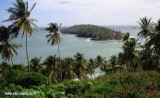
Un site sympa très calme surtout à l'abri des intempéries. Vous tomberez sous le charme de cette ville dont l'histoire est particulièrement intéressante avec les vestiges du bagne, les nombreuses populations d'origines diverses.Plus d'infos : eileen_of_avoca@yahoo.com
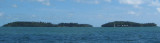
Îles du Salut, 3 in number, are located about 7 NM NE of Pointe Charlote.Ile du Diable, the northernmost, is 40m high. Ile Royale, 66m high, is the largest and westernmost, while Ile Saint-Joseph, only 30m high, is the southernmost.
Île du Diable part of Salut islands is better known as Devil's Island. The total area is 0.62 km2 (62 hectares) The islands were used as a penal colony from 1852 onwards, earning them a reputation for harshness and brutality. This system was gradually phased out and has been completely ...


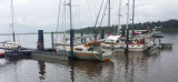


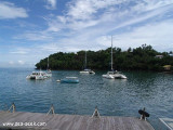
 Petit port de Ferry.
 Ferry port .