Pulau Karimun Kecil (E Sumatra)
3.4nm
20°
In the NW approach to the channel between Great Karimun and Little Karimun are two islets, Nangoi, 39m high, about 1.2 miles W of the ...
1 Feb 12
Jojo
| Latitude | Longitude | |
| DMS | --- | --- |
| DM | --- | --- |
| DD | --- | --- |

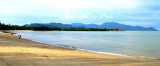
 Karimun Besar is a small island in the Riau Islands. It lies west of Batam and to the southwest of Singapore and is the furthest west of the Riau Islands.
Karimun Besar or Great Karimun, is mountainous at its N end, the principal peaks being Betina, 416m high standing 1.75 miles SW of the N extremity, and Djantan, 453m high, about 1.25 miles S of Betina.
The S end of the island, except near Tanjung Balai, consists of low, swampy ground.On the E side of Great Karimun, a bay is formed between Tanjung Bula Kasap, the NE point of the island, and Tanjung Sebatak, about 5 miles SSE. This bay is fouled by a shallow mud bank which extends about 1 mile offshore, out to the line of its entrance points.
Its main town, Tanjung Balai is a bustling port town with a lot of commerce, boosted by tourists from Singapore and Malaysia, however, it must not be confused with Tanjung Balai in North Sumatra province, a much larger city also known as Tanjung Balai Asahan and an international port. However, like Batam and Bintan, Karimun is also listed as a Free Trade Zone area.
Ebook | Sumatra (Indonesia)
|