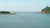

Kalabadevi Bay (W India)
1.1nm
33°
2 Mar 12
Jojo
| Latitude | Longitude | |
| DMS | --- | --- |
| DM | --- | --- |
| DD | --- | --- |
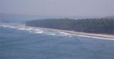
 Vada Mirya (Mirya Donghur), a high rocky headland, is lighter in color than the adjacent coast, and resembles an island when seen from the N or S. The W end of the headland terminates in steep cliffs. Mirya Peak, 142m high, the conspicuous summit of this headland, lies about 0.5 mile NNE of Miyet Point, the SW extremity of the headland.
Sookana Shoals, with a least depth of 9.4m, lie about 1 mile NNW of Sookana Point, the NW extremity of Vada Mirya.
Ebook | Arabian Sea
|