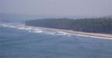
Pavas Bay (Paos Bay) is entered S of Pavas Point, Golap Hill, 120m high, lies about 1 mile NE of Pavas Point. Vessels can anchor in Pavas Bay, in a depth of about 8.5m, mud and sand, sheltered from NW winds. The coast between Pavas Bay and Purangad Bay, about 5 miles S, consists of rocky tableland and sandy bays, and is free from dangers.
Purangad lighthouse is shown, except during the strength of the Southwest Monsoon, from the N entrance point of Purangad Bay. About 1 mile farther E, a ruined fort stands on a bare hill on the N side of the entrance to the Machkandi River. Khavri, a mountain 346m high, lies about ...
Mudle Shoal (Taylor Shoal), with a least depth of 1.1m, and marked on its S side by a buoy, lies about 0.7 mile SE of Miyet Point. The sea breaks over this shoal at LW.
Vada Mirya (Mirya Donghur), a high rocky headland, is lighter in color than the adjacent coast, and resembles an island when seen from the N or S. The W end of the headland terminates in steep cliffs. Mirya Peak, 142m high, the conspicuous summit of this headland, lies about 0.5 mile ...
Kalbadevi Bay is entered between Sookana Point and Kurne Point.Anchorage may be obtained, in 8m, about 0.7 mile E of Sookana Point and 0.3 mile offshore. Local vessels call here during the Southwest Monsoon.
A light is shown from a tall, white, square, concrete tower with black bands on Wagapur Point; foul ground extends about 0.1 mile WNW of the point. The coast between Wagapur Point and Vijayadurg Harbor, about 2 miles S, consists of cliffs about 21m high. Holi Hill, 85m high, about ...


 Pavas Bay (Paos Bay) is entered S of Pavas Point, Golap Hill, 120m high, lies about 1 mile NE of Pavas Point.