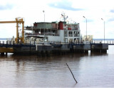

Water islands (Malacca - Malaysia)
38nm
33°
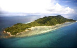
The Water Islands, centered about 8 miles SE of Melaka, consists of a group of six tree-covered islands of moderate ...
5 Jan 12
Jojo
| Latitude | Longitude | |
| DMS | --- | --- |
| DM | --- | --- |
| DD | --- | --- |

 Selat Bengkalis lies between the SW side of Pulau Bengkalis and Sumatera and is entered W of Tanjung Jati, the W extremity of Pulau Bengkalis, which stands about 19 miles SE of Tanjung Masim. The N approach is deep and presents no difficulty if the buoyed channel is followed.
The W shore of the approach, from the NE extremity of Pulau Rupat to Tanjung Masim is covered with low trees and coveredat HW. Tall trees stand inland.
Shoals, with depths from 3 to 11m, extend up to 20 miles N and NW from Tanjung Jati.
A shoal, with a depth of 7.2m, lies about 4 miles WNW of Tanjung Jati. A shoal, with a depth of 10.6m, lies on the SW side of the strait about 4.7 miles SW of the same point.
Southward of Tanjung Balai, about 17 miles SE of Tanjung Jati, Selat Bengkalis becomes Selat Lalang.
Selat Lalang leads into Selat Pandjang and this strait has considerable depths for about 60 miles but is then fouled by islets and shoals.
Ebook | Sumatra (Indonesia)
|