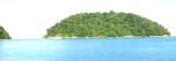
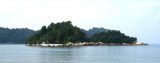
Mentangor is a large uninhabited island along S of Teluk Nipah.There were nothing worth
highlighting on the island except the scenes of rocky coast and some
tiny beaches. Next to it is the smaller, tiny Coral island with shallow water.
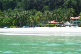
Off the coast of perak State, north of Selangor , lies a cluster of fabulous islands with unquestionably some of the best coves and beaches on the western coast of peninsular Malaysia.
Among them, two islands predominate in terms of accessibility, infrastructure and development ...
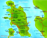
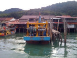
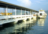
Located E coast of Pulau Pangkor in a shallow bay Port Pangkor, in front of Pangkor village, has a small jetty, with a depth of 6,1 m alongside.Tides_Currents:The flood runs S, and the ebb N along the W coast of Pulau Pangkor. taking the direction between Pulau Pangkor and Pulau Pangkor ...


 Western Anchorage is entered between Tanjong Nipah and the W extremity of Pulau Mentangor, about 1 mile SSW.
 (Malaysia)")
 (Malaysia)")