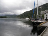
Ulvik is a village in the innermost part of the Hardangerfjord. The warm summers and nice nature attract tourists. Few places on the wharf for yacht or sailing boats.
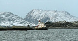
Stabben lighthouse is a leading ligthouse situated on an islet at the entrance to Florø in Flora municipality in Sogn and Fjordane. The lighthouse was commissioned in 1867. Lighthouse is notched and stands on a high stone wall and has a low roof tower. The tower was built higher ...


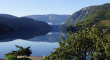


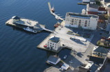
 Situé tout au fond du Geirangerfjord, l'un des plus beaux de Norvège.