Santo Antonio

Santo Antonio

Para ubicar con precisión. Actualizar si es necesario.

Ubicación

Santo Antonio
LatitudeLongitude
DMS------
DM------
DD------

Característica

Puerto
Primeros auxilios
Astillero

Descripción

Petit port côtier.
2012/02/12
Actualizar
sporkxx
Small port.
2012/02/12
Actualizar
sporkxx
Santo Antonio
2012-02-12
Actualizar
sporkxx
Ebook

Gulf of Guinea

  • 18 sites
  • 9 photos
  • publication date: 9 Jul 2023
  • .pdf file size: 6 Mb
Comparta sus comentarios o fotos en "Santo Antonio"

Sitios alrededor de Santo Antonio

Flying distances - Direct line

Santa Cruz (Sao Tome)

101nm
207°
Your comments are welcome - If you would like to add your own report on a marina, harbour, beach or anchorage please click on the "Edit" tab above, delete this text and type your comments. Digital photos are also very welcome using the "photo" link in the left menu. - Regards - The Webmaster
28 Jul 11
Wikiadmin2

Cap Lopez

156nm
150°
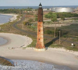
SituationLe cap Lopez est situé à la pointe nord de l'île Mandji, dans le delta de l'Ogooué, au Gabon. Le phare, construit en 1911 pour remplacer le premier phare construit en 1897, n'est plus en fonctionnement et menace de s'effondrer à cause de l'érosion côtière. 
30 ...
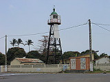
20 Jun 10
Anonymous

Port Gentil

164nm
149°
Port de commerce côtier.
12 Feb 12
sk83rfr3k

Douala

197nm
43°
Port de commerce .
12 Feb 12
SaywhatMD

Warri

253nm
336°
Petit port .
12 Feb 12
Juan

Burutu

250nm
332°
Petit port .
12 Feb 12