Cape Negrais (Burma)
148nm
259°
The coast between Cape Negrais ...
21 Nov 11
Jojo
| Latitude | Longitude | |
| DMS | --- | --- |
| DM | --- | --- |
| DD | --- | --- |

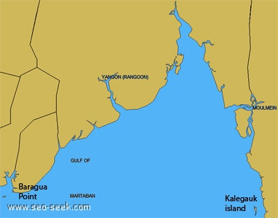
 The Gulf of Martaban is entered between Baragua Point and the coast extending N abreast of Kalegauk Island, about 140 miles to the E.
In 1981, a dangerous wreck was reported to lie in position 15°20'20"N, 96°36'12"E, about 60 miles SSE of Rangoon River Western Channel Entrance.

Ebook | Andaman sea
|


