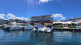
La partie française, appelée Saint-Martin, occupe la partie nord avec Marigot comme chef-lieu, tout en constituant avec Saint-Barthélemy une collectivité territoriale française. La partie néerlandaise, appelée Sint Maarten (en néerlandais) avec Philipsburg comme chef-lieu, ...
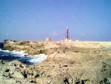
Sombrero, aussi appelé Hat Island, est une petite île située au nord-ouest de l'île d'Anguilla à 55 km. C'est l'île la plus au nord des petites Antilles. L'île mesure environ 1,5 km de long pour 0,4 km de large. L'île est inhabitée depuis 2002, auparavant elle était habitée ...
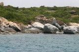
The Prickly Pear Cays, are a small pair of uninhabited islands about six miles from Road Bay Anguilla. They are is divided by a narrow channel into Prickly Pear east and Prickly Pear west. The islands are popular with tourists, due to their abundant marine and bird life. There ...