Vestmannaeyjar

Vestmannaeyjar

To precisely geolocate this site. Update if necessary.

Localisation

Vestmannaeyjar
LatitudeLongitude
DMS------
DM------
DD------

Characteristics

Port
Water
Fuel
First aid
Shipyard
Grocery

Description

naturalPort.
2012/12/31
Update
dd
Port côtier.
2011/04/16
Update
Anonymous
Vestmannaeyjar
Hansueli Krapf
2012-12-31
Update
dd
Ebook

Iceland

  • 25 sites
  • 12 photos
  • publication date: 8 Jul 2023
  • .pdf file size: 13 Mb
Share your comments or photos on "Vestmannaeyjar"

Sites around Vestmannaeyjar

Flying distances - Direct line

Hafnarfjordur

58nm
309°
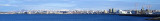
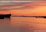
Looking for an enjoyable and unique place to visit? Look no further. Take a break in Hafnarfjördur, the warm-hearted town in the lava, just south of Iceland?s capital Reykjavík.Hafnarfjördur?s name simply means ?harbour fjord? and refers to the excellent natural harbour, which ...
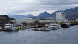
23 Dec 10

Straumsvik

59nm
307°
Small natural port.
16 Apr 11
Anonymous

Reykjavik

61nm
313°
Harbor protected by a breakwater.
31 Dec 12
dd

Skagastrond

142nm
359°
Small natural port.
16 Apr 11
Anonymous