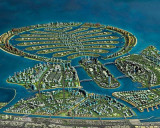
Umm Al Qaywayn emirate

Umm Al Qaywayn emirate

To precisely geolocate this site. Update if necessary.

Localisation

Umm Al Qaywayn emirate
LatitudeLongitude
DMS------
DM------
DD------

Characteristics

Coast

Description

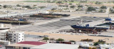
Umm Al Quwain  is one of the 7 emirates between Ajman and Ra's al Khaymah on the West coast of the United Arab Emirates.

It covers  an area of 800 square kilometres and stretches from the beautiful, lush green coastal mangroves lining the shores of the Persian Gulf, inland across the rolling sand dunes to the fertile oasis surrounding Falaj Al Moalla.

The inland oasis and hinterland town of Falaj Al Moalla lies some 50km from Umm Al Quwain city.

The name Umm Al Quwain is derived from Umm Al Quwatain, which means "Mother of two powers", a reference to the powerful seafaring tradition of this emirate.

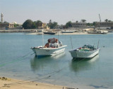
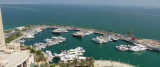
Khawr Umm al Qaywayn  is an inlet comprising an extensive backwater in which are several low islets. Extensive banks, with drying patches, extend seaward from Jazirat as Siniyah and from the peninsula of Umm al Qaywayn.

Between these two banks is a narrow channel leading to Khawr Umm al Qaywayn. It is entered between the W extremity of Jazirat as Siniyah and the peninsula of Umm al Qaywayn.

Jazirat Mallah, separated from Jazirat Siniyah by salt pans covered at HW, extends 5 miles NE. Burj Mallah, the SW of two conspicuous rectangular towers, stands near the SW end of Jazirat Mallah. A dangerous wreck lies 7 miles N of the entrance to Khawr Umm al Qaywayn.

2011/10/10
Update
JB Antibes
Ebook

Persian Gulf - Arabian Gulf

  • 61 sites
  • 71 photos
  • publication date: 7 Jul 2023
  • .pdf file size: 37 Mb
Share your comments or photos on "Umm Al Qaywayn emirate"

Sites around Umm Al Qaywayn emirate

Flying distances - Direct line

Palm Deira (Dubai)

24nm
198°
The Palm Deira is an artificial archipelago under construction, located alongside Deira town.The largest of the three Palm Islands, Palm Deira on completion will cover an area greater than the city of Paris. Featuring 8,000 two-storey houses, villas, and town homes, it is a ...
15 Oct 11
Joëlle

Khwr Umm Al Qaywayn port

14nm
132°
Khawr Umm Al Qaywayn is an old natural coastal harbor  located in the old town overlooking the traditional dhow building yard where skilled craftsmen continue to assemble these traditional boats. The harbor is surrounded by old coral stone houses that ...
10 Oct 11
JB Antibes

Al Hamriyah (Ajman)

17nm
160°
Al Hamriyah is a village about 7 miles SSW of Umm al Qaywayn. The tower of a new fort, with a flagstaff and a white minaret, are conspicuous. There is a creek at the S end of the village which connects at HW with Khawr Ajman. The creek was dredged (2004) ...
12 Oct 11
Joëlle

Khalid Port (Sharjah)

22nm
178°
Department of Seaports and Customs owns and controls the emirate’s three ports (the Port of Hamriyah, Khor Fakkan, and Khalid). The Gulftainer Company Limited was formed in 1976 to operate and manage the Sharjah Container Terminal at the Port of Khalid and the terminal at Port of ...
14 Oct 11

Ajman port

19nm
167°
The Port of Ajman is located on the Gulf coast approx 8km NE of Sharjah, on the S side of the entrance to Khawr Ajman.General overview: Numerous fishing vessels and dhows operate from the port, Containers and general cargo are handled here.The entrance channel has been dredged ...
12 Oct 11
JB Antibes

Al Jazeera Port (Ras Al Khaimah)

23nm
93°
Al Jazira port fronts Jazirat al Hamra, which was once an island but is now part of the mainland.
The port exports rock and aggregates from nearby quarries but can also handle bulk, liquid, ro-ro, container, and general cargo.Tides—Currents.—The mean maximum ...
10 Oct 11
Joëlle