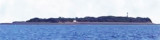

Magdalla port (W India)
6.4nm
75°
The actual port of Magdalla is located about 5 miles upstream on the S bank of the ...
1 Mar 12
Jojo
| Latitude | Longitude | |
| DMS | --- | --- |
| DM | --- | --- |
| DD | --- | --- |

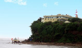
 Suvali Point, the E entrance point of the Gulf of Cambay, is fringed by the drying coastal reef which extends about 1 mile W of the point.
Between the entrance to Tena Creek and the entrance to Sena Creek, about 9 miles N, the coast is fringed with thick groves of palmyra trees. The Kim River, about 2 miles farther N, dries in its entrance.
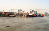
Tena Bank-Outer Bhagwa Sand, one continuous narrow bank nearly parallel with the coast, lies between the entrance to Tena Creek and the S entrance of the Kim River. Tena Bank, the S part of which dries, is a continuation of Outer Bhagwa Sand, the N part of which dries in patches. Bhagwa Channel, E of the above bank, is used only by small vessels with local knowledge.
Ebook | Arabian Sea
|