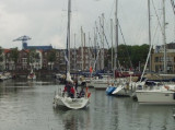
The town of Veere is in Zeeland, near Middelburg on the - former - island of Walcheren, has a small picturesque harbour. Old fortifications have decided its lay-out, dominated by the huge bulk of the Church of Our Lady (or 'Grote Kerk'), which once provided barrack-space for Napoleon's ...
Breskens provides for a stop-over for those who are too tired to already overtake the Westerschelde mouth crossing to Vlissingen (Flushing). Port control is accessible on VHF 14 and the harbour is accessible at all tides. Watch out for the wreck located close to the shore West to ...


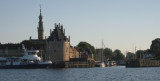


 Commercial harbour. Main industry is the Damen Schelde Naval Shipbuilding (military ships and cargos).