Enter your comments here. Location Provide details or delete Entrance Navigation The average dept at lowest astronomical tide (LAT) is 5 meters inside the basin and outside the breakwater is more than 7 metres. Arrival Requirements All visiting vessels are required ...
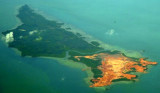
Pulau Telan (Telang), the SW point of which forms the SE limit of Selat Riau, is irregularly shaped and nearly 5 miles long, NE and SW, and about 1 mile wide. It is divided into two parts and may be identified by a square hillock on its S end, 63m high, which, with a sharper peak ...
The Merodong group of islands lie to the W of Pulau Mesanak, between it and the Temiang group. The former group comprises six islands, separated by channels unsuitable for navigation and there is no reason in venturing among them or between them and Pulau Mesanak. Merodong, the ...


 Small port .
 Petit port .