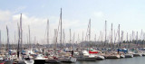

Île d'Oléron
38nm
154°
17 Mar 13
pre
| Latitude | Longitude | |
| DMS | --- | --- |
| DM | --- | --- |
| DD | --- | --- |

 La Loire Estuary
The Estuary of the La Loire comprises the area fronting the mainland between Pointe du Croisic and Ile du Pilier. It is roughly divided into two parts by Plateau de la Banche, a dangerous shoal area, and can be entered from the S by Chenal du Sud or from the N by Chenal du Nord.
La Loire
La Loire, one of the principal rivers in France is available to ocean-going vessels
only as far as Nantes, 30 miles above the mouth.
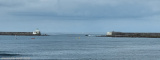
Saint Nazaire
It is an important commercial port and shipbuilding center, lies on the N bank of La Loire, 5 miles within the entrance.
Ile d’Yeu
Ile d'Yeu, is a good landmark when
approaching La Loire from the S.
The SW part of Ile d’Yeu is steep and attains a height of
30m, but the SE part is low and flat.
Ile de Re
The island is moderately low. It is separated at the E end from the mainland by Coureau de la Pallice, which is spanned by a bridge.
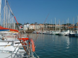
Ile d’Oleron
The island is low and has numerous sand dunes covered with pine trees. The highest dunes attain heights of about 28m and stand in the S part of the island. The NE coast of the island forms the S side of Pertuis d’Antioche. A viaduc crosses Coureau d’Oleron which separates the SE coast of the island from the mainland.
Ebook | Golfe de Gascogne
|