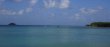
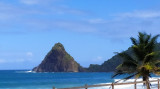
Closed by a coral reef which protects it from the waves of the open sea, the Baie du François is a vast shallow aquarium, rarely more than 10 meters, interspersed with white bottoms (strips of sand on which you walk) and small islands. The islets Oscar, Thierry, Long, Frégate, Métrente, ...
Houlographe de Basse Pointe fournissant des mesures en temps réel de la houle. Extrait du site http://candhis.cetmef.developpement-durable.gouv.fr/ Meteo


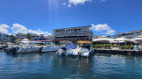


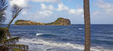
 Petit port de pêcheurs en fond de "Baie de Fonds d'Or". Jetée en chicane à l'entrée pour briser la houle de l'Atlantique.
 Accès étroit et sujet à la houle.