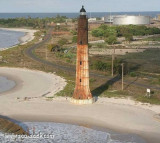
SituationLe cap Lopez est situé à la pointe nord de l'île Mandji, dans le delta de l'Ogooué, au Gabon. Le phare, construit en 1911 pour remplacer le premier phare construit en 1897, n'est plus en fonctionnement et menace de s'effondrer à cause de l'érosion côtière. 30 ...
Your comments are welcome - If you would like to add your own report on a marina, harbour, beach or anchorage please click on the "Edit" tab above, delete this text and type your comments. Digital photos are also very welcome using the "photo" link in the left menu. - Regards - The Webmaster
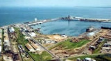
Pointe Noire is the seaport for the Congo, on the western coast of Africa. The port of Pointe-Noireis a vital communication axis in equatorial Africa, stretching from Pointe-Noire to Bangui and Ndjamena, through the railway line.Pointe_Noire


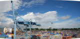
 Harbor.
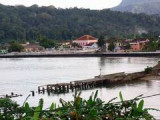
 Port de commerce côtier.