Otok Sv. Grgur, Goli et Prvic

Otok Sv. Grgur, Goli et Prvic

To precisely geolocate this site. Update if necessary.

Localisation

Otok Sv. Grgur, Goli et Prvic
LatitudeLongitude
DMS------
DM------
DD------

Characteristics

Coast
Mud
Mooring
Lighthouse

Description

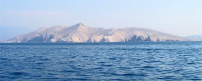
These three islands are N of the island of Rab.

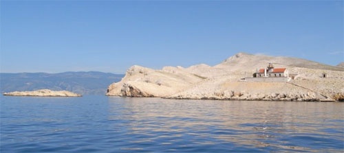
Otok Goli, bare and precipitous in its NE part, lies on the W side of Velebitski Kanal 9 miles NNW of Jablanac.
This island is generally steep-to except at its SE extremity where a rocky reef extends up to about 0.5 mile SE.
Rt Sajalo, the NW extremity of the island, is marked by a light and fringed by rocks.

Otok Sveti Grgur, 225m high, lies 1 mile NW of Otok Goli. This island is also mostly steep-to and bare, with some bushes on its S side.

Otok Privic, 357m high, is hilly, barren, and steep-to. Rt Strazica, the NW extremity of the island, is marked by a light. It is reported that a prominent tree stands 0.4 mile SSE of this point.
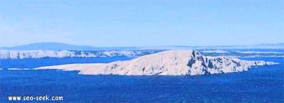
Under the communist regime Goli Otok Grgur and were prohibited areas. All housed two prison camps.
A bay on the NW coast of Otok Grgur allows anchor if you're surprised by the Bora. This anchorage is protected from NE to S by E.
There is no shelter on Otok Prvic.
2011/08/4
Update
Jojo
Otok Sv. Grgur, Goli et Prvic
Otok Goli
2011-08-04
Update
Jojo
Ces 3 îles sont au N de l'île de Rab.

Otok Goli, nue et abrupte dans sa partie nord, se trouve sur le côté W de Velebitski Kanal à 9 M au NNO de Jablanac.
Cette île est généralement accore, sauf à son extrémité SE où un récif rocheux s'étend jusqu'à environ SE 0.5 mile.
Rt Sajalo, l'extrémité nord-ouest de l'île, est marqué par une lumière et bordée par des rochers.
Otok Sveti Grgur, 225m de haut, se trouve à 1 mile au NO de Goli Otok. Cette île est aussi souvent escarpée et nue, avec quelques buissons sur le côté S.

Otok Privic
, 357m de haut, est vallonnée, stérile, et raide. Rt Strazica, l'extrémité nord-ouest de l'île, est marqué par une lumière. Il est rapporté qu'un arbre remarquable se trouve à 0.4 mile au SSE de ce point.
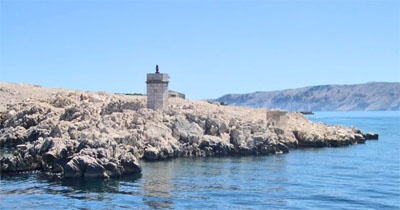
Sous le régime communiste Otok Grgur et Goli étaient des zones interdites. Toutes 2 abritaient des camps de prisonniers.
Une baie sur la côte NW de Otok Grgur permet de mouiller si l'on est surpris par la Bora. Ce mouillage est protégé du NE au S par l'E.
Il n'y a aucun abri sur Otok Prvic.
2011/08/4
Update
Jojo
Otok Sv. Grgur, Goli et Prvic
Rt Sajalo O. Goli
2011-08-04
Update
Jojo
Otok Sv. Grgur, Goli et Prvic
Otok Sveto Grgur
2011-08-04
Update
Jojo
Otok Sv. Grgur, Goli et Prvic
Otok Prvic
2011-08-04
Update
Jojo
Otok Sv. Grgur, Goli et Prvic
Rt Strazica O. Prvic
2011-08-04
Update
Jojo
Share your comments or photos on "Otok Sv. Grgur, Goli et Prvic"

Sites around Otok Sv. Grgur, Goli et Prvic

Flying distances - Direct line

Rapski Kanal

1.8nm
195°
Rapski Kanal is deep and leads between Otok Sveti Grgur and Otok Rab.
This channel is seldom used as the fairway is only 0.3 mile wide in places and several rocky patches lie adjacent to its S side.
4 Aug 11
Jojo

Otok Olib Zadar

29nm
180°
Otok Olib is located E of O. Silba. It belongs to Zadar archipelago.The island has been inhabited since Roman times. The residents bought their island in 1900. The only village on the island was established around the port.
To the east of the island you will find some small hidden ...
27 Jul 11
Jojo

Olipski Kanal

29nm
184°
Olipski Kanal leads NNW between the E side of Otok Silba and the W side of Otok Olib and merges into the N end of Pohlipski Kanal.
This channel is deep and has a minimum navigable width of 0.7 mile. It is often used by vessels proceeding to and from Zadar.
Good anchorage is ...
18 Sep 11
Jojo

Barbatski Kanal

9.4nm
174°
Il y a plusieurs baies dans Barbatski Kanal, entre l'île de Rab et l'île Dolin. Ces baies sont d'agréables mouillages le temps d'un déjeuner.
2 Aug 11
Jojo

Otok Plavnik Kvarner

12nm
295°
Otok Plavnik lies with Rt Veli Pin, its N extremity, located 0.7 mile E of the E side of Otok Cres and divides Srednja Vrata in its S part into two channels.
This cliffy island is 194m high and partly wooded.
Several small islets lie on a shoal bank which extends about 1.5 miles ...
4 Aug 11
Jojo

Kanal Krusija

12nm
295°
Kanal Krusija leads to the W of Otok Plavnik.
This channel is frequented because of its steep-to shores and deep passage.
A strong current may occasionally be experienced in this channel, depending on local weather conditions, but this passage is recommended over the one leading ...
4 Aug 11
Jojo