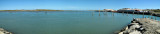
Enter your comments here. Location The entrance to Tauranga harbour is to the west of the 230 metre high Mount Maunganui, which is visible from many miles to seaward. Entrance Navigation The harbour entrance should be approached from the North East to avoid coming ...
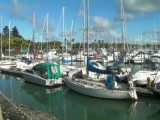
Chaffers Marina is a floating marina, with a prime location next to Te Papa in the inner harbour. Completed in 1993, the marina offers facilities and services for both visiting vessels and private berth owners. Berth sizes currently range from 10 metres to 20 metres. Located in ...


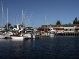


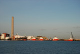
 Port protected by a breakwater.
 Port protégé par une digue.