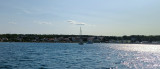
Marina Kornati et marina Sangulin Biograd

Marina Kornati et marina Sangulin Biograd

To precisely geolocate this site. Update if necessary.

Localisation

Marina Kornati et marina Sangulin Biograd
LatitudeLongitude
DMS------
DM------
DD------

Characteristics

Port
VHF 17
Water
Electricity
Fuel Ouside the marina
Shipchandler
Shipyard
Shower
WC
Laundry
Market
Grocery marché
Restaurant
Post
Bank

Description

Marina Kornati et marina Sangulin Biograd
2011-04-02
Update
Jojo
Marina Kornati et marina Sangulin Biograd
2011:08:14 10:27:56
2011-08-14
Update
Croatia
This marina is located near the archipelago of Kornati, Biograd Na Moru-center of what is called the "Riviera Biograd.
Each year are given over 40 national and international regattas for all classes and more than 30 fleets, attended by about 10,000 sailors worldwide.
The marina consists of two parts: the Western (marina Kornati) and Part S (marina Sangulin).
The width of the entrance to the marina is 40 m with a depth of 6.50 m.
Approach: From the S attention to shoal (3.30 m) extending to about 0.2 M in E Otocic Sv Katarina, the most to the S of the two islands to Biograd.
From the N, the marina entrance is N of the city, 1.1 M SE of fire Plicina Kocerka. Beware the green buoy unlit indicating a shoal, between Ferry docks and entrance to the marina.
Total protection
Tel: +385 (0) 23 383 800
Fax: +385 (0) 23 384 500
Mail: info@marinakornati.com
750 b.
The refuelling station is outside the 2 marinas, close to the Ferry port.
2011/08/16
Update
Croatia
Marina Kornati et marina Sangulin Biograd
2011:08:15 10:51:27
2011-08-16
Update
Croatia
Cette marina est située, près de l'archipel des Kornati, à Biograd-Na-Moru, centre de ce que l'on appelle le "Biograd Riviera".
Chaque année sont données plus de 40 régates nationales et internationales, pour toutes les classes et plus de 30 flottilles, fréquentées par environ 10 000 marins du monde entier.

La marina est formée de deux parties: la partie occidentale (marina Kornati) et la partie S (marina Sangulin).
La largeur de l'entrée de la marina est de 40 m avec une profondeur de 6,50 m.

Approche: En venant du S attention au haut-fond (3,30 m) qui s'étend à environ 0,2 M dans l'E de Otocic Sv. Katarina, la plus au S des deux îles devant Biograd.
En venant du N, l'entrée de la marina est au N de la ville, à 1,1 M au SE du feu de Plicina Kocerka. Attention à la bouée verte non lumineuse signalant un haut-fond, entre les quais des Ferries et l'entrée du port de plaisance.

Protection totale
Tel: +385 (0) 23 383 800
Fax: +385 (0) 23 384 500
Mail: info@marinakornati.com
750 pl.

2011/08/14
Update
Croatia
Ebook

Zadarska županija (Zadar county)

  • 85 sites
  • 112 photos
  • publication date: 11 Jul 2023
  • .pdf file size: 39 Mb
Ebook

Dalmacija (Dalmatie)

  • 542 sites
  • 910 photos
  • publication date: 9 Jul 2023
  • .pdf file size: 302 Mb
Share your comments or photos on "Marina Kornati et marina Sangulin Biograd"

Sites around Marina Kornati et marina Sangulin Biograd

Flying distances - Direct line

Otok Murter

11nm
138°
The island of Murter is the largest island of the Sibenik archipelago. It is close to the coast on which it is connected by a bridge, low air draft at Tijesno (Tisno) on the continent. During the summer the bridge opens to allow passage of boats.
The NW part of the island is fertile ...
3 Apr 11
Jojo

Novigradsko More

15nm
15°
Novigradsko More, a landlocked bay, lies at the S end of Novsko Zdrilo and provides good anchorage.
Rijeka Zrmanja flows into the bay at the E side. This river is navigable by small craft as far as the village of Obrovca, 6 miles above the mouth.
Luka Novigrad, a narrow inlet, ...
23 Jul 11
Jojo

Vrgadski Kanal

6.5nm
144°
Vrgadski Kanal, 7 miles long, leads between Otok Murter and Otok Vrgada and is the principal channel used in the S approach to Pasmanski Kanal and Zadar.
Vessels with a maximum draft of 6.4m may pass through Pasmanski Kanal. Vessels with drafts over 6.4m must either proceed through ...
16 Jul 11
Jojo

Otok Zirje (Sibenik)

20nm
149°
Otok Zirje is the farthest and the largest island in the Sibenik archipelago.
It is long of 6,5 NM (NW/SE) and 1,4 NM wide.
The main village, Zirje, is located in the middle of the island. A small port, luka Muna, on the coast N of Zirje, home to the ferry that connects the ...
16 Aug 11
Croatia

Kanal Nove Povljane Vir

27nm
327°
Kanal Nove Povljane, entered between Otok Vir and the SE end of Otok Pag, leads 5 miles SE into Ninski Zaliv.
Shoals at the inner end of this channel restrict the fairway to a width of about 250m, with a controlling depth of 8m. Vessels with a draft of over 6m are advised not to ...
23 Jul 11
Jojo

Rivanjski Kanal

22nm
305°
Rivanjski Kanal continues NW from the N end of Srednji Kanal and leads between Otok Rivanj andOtok Sestrunj.
It is generally used by vessels proceeding between Srednji and Zadarski Kanals.
Otocic Tri Sestrice, a group of islets and rocks, extend up to 2 miles NW of Rt Zanavin, ...
9 Sep 11
Jojo