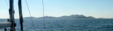
Uvala Dugo Vaca is a cove surrounded by docks, near the village of Drage (Draje), on the mainland, facing Zavinac islands (Mali and Veli zavinac). Approach: no risk. We tied up at one of the docks by 2-3 m. Good protection by S NE W.
Since 2023 a new Marina is implemented.
2011/09/11
Update
Jojo
Uvala Dugo Vaca est une anse bordée de quais, près du village de Drage (Draje), sur le continent, face aux îlots Zavinac (Mali et Veli Zavinac). Approche: aucun danger. On s'amarre à l'un des quais par 2 à 3 m. Bonne protection du S au NE par l'W.
Une nouvelle Marina est opérationnelle depuis 2023.
Vrgadski Kanal, 7 miles long, leads between Otok Murter and Otok Vrgada and is the principal channel used in the S approach to Pasmanski Kanal and Zadar. Vessels with a maximum draft of 6.4m may pass through Pasmanski Kanal. Vessels with drafts over 6.4m must either proceed through ...
Otok Zirje
is the farthest and the largest island in the Sibenik archipelago. It is long of 6,5 NM (NW/SE) and 1,4 NM wide. The main village, Zirje, is located in the middle of the island. A small port, luka Muna, on the coast N of Zirje, home to the ferry that connects the ...
Novigradsko More, a landlocked bay, lies at the S end of Novsko Zdrilo and provides good anchorage. Rijeka Zrmanja flows into the bay at the E side. This river is navigable by small craft as far as the village of Obrovca, 6 miles above the mouth. Luka Novigrad, a narrow inlet, ...
Kaprije is located in the central part of the Sibenik archipelago between the islands Zmajan and Kakan. The highlight of the island is Vela Glavica (132 m). The only village of the island is Kaprije, S. The port is busy. Automobiles are not allowed on the island.
Kanal Nove Povljane, entered between Otok Vir and the SE end of Otok Pag, leads 5 miles SE into Ninski Zaliv. Shoals at the inner end of this channel restrict the fairway to a width of about 250m, with a controlling depth of 8m. Vessels with a draft of over 6m are advised not to ...


 quais
quais


 village


 Uvala Dugo Vaca is a cove surrounded by docks, near the village of Drage (Draje), on the mainland, facing Zavinac islands (Mali and Veli zavinac).
 Uvala Dugo Vaca est une anse bordée de quais, près du village de Drage (Draje), sur le continent, face aux îlots Zavinac (Mali et Veli Zavinac).
 New Marina since 2023