Konipafuri

Konipafuri

To precisely geolocate this site. Update if necessary.

Localisation

Konipafuri
LatitudeLongitude
DMS------
DM------
DD------

Characteristics

Description

Ebook

Maldives

  • 128 sites
  • 118 photos
  • publication date: 9 Jul 2023
  • .pdf file size: 19 Mb
Share your comments or photos on "Konipafuri"

Sites around Konipafuri

Flying distances - Direct line

Muli (Maldives)

30nm
91°


Muli est une île de 1500 hab, assez grande et très jolie. Il y a plusieurs restaurants, plein de petits magasins, un hôpital, une école.
5 May 11
dd

Vattaru Atholl (Maurice)

30nm
50°
Situé au S de Vaavu atoll, Vattaru atoll, de forme circulaire, a 9km de diamètre. Il comporte une seule île inhabitée.
7 Jan 08

Mulaku Kandu (Maldives)

35nm
74°
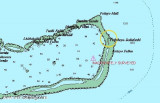
Mulaku Kandu has the unusual feature of a large submerged pinnacle rising from very deep water in the centre of the channel. The pinnacle is covered with beautiful soft corals and surrounded by a myriad of marine life. The channels on the western rim of the atoll will also make fantastic ...
7 Jan 08

Dhiggiri (Maldives)

51nm
31°
Dhiggiri is a small and friendly island with a white sandy beach and a blue lagoon.
12 Jan 08

Foththeyo Bodufushi (Maldives)

52nm
53°
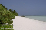
The reefs of the eastern side of the atoll are in pristine condition and are wonderful for divers and snorkellers alike. There are many thrilling shark dives in the atoll, where divers may be lucky enough to see hammerhead sharks as well as the more common grey reef sharks.
5 Jan 08

Rihivelli island (S Kaafu)

57nm
22°
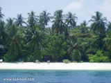
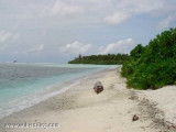
Au bord de la barrière de corail, au S de l'atoll de Male S, lîle est longue de 350m et large de 75 m avec une orientation NS.
Deux îles désertes sont accessibles à pied, en planche à voile ou en catamaran: l'île aux Oiseaux l'île du Soleil Levant.L'île Robinson à l'état ...
1 Feb 09
anonymous