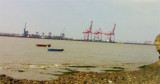

Piparav Bandar port (W India)
11nm
56°
29 Feb 12
Jojo
| Latitude | Longitude | |
| DMS | --- | --- |
| DM | --- | --- |
| DD | --- | --- |


 Jafarabad is an open roadstead affording little protection during the Southwest Monsoon. Theharbor is shallow and a ledge of flat rocks extends nearly 0.5 mile W from the E side of the harbor entrance.
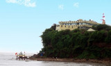
Jafarabad is a walled town, with several round towers, on the highest ofwhich there is a flagstaff, 35m high. The town, situated on high ground, can be seen from the S and E over the intervening rising ground, about 1 mile inland on the W bank of the river ofthe same name.
the shore near the cement factory on the E side. A second breakwater extends ENE about 0.3 mile from the W entrance point of the bay. A light shows from the W breakwater head.
Outside the harbor, the tidal current sets E with the flood and W with the ebb along the coast.
At springs, the E current continues to run for about 1 hour after the time of HW, and the W current continues to run until 4 hours before the time of the following HW. Both currents attain a maximum velocity of 4 knots after running for 3 hours.
At neaps, the E current continues to run for 30 minutes after the time of HW, and the W current continues to run until 4.5 hours before the time of the following HW. The maximum velocity of the flood is 1.8 knots and of the ebb 1.5 knots.
At neaps, the current changes from ebb to flood in a clockwise direction and the flood to ebb in a counterclockwise direction.
A channel about 40m wide, being dredged to a depth of 5.5m in 1986, leads to a dredged basin of the same depth having a diameter of 300m, around the Lshaped jetty. Range lights, in line bearing 222°°, lead to the jetty.
Barman Hill, 106m high, is conspicuous about 6.5 miles NNW of Jafarabad. Lor Hill, 146m high, about 3 miles W of Barman Hill, is also conspicuous.
A chimney, 90m high, and a conspicuous tower, 102m high, are situated close together at a cement factory on the E entrance point of the river.
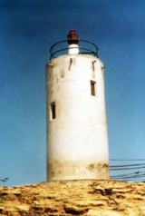
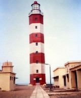
Lights are shown from the SW and NE entrance points of the harbors. A white beacon marks the W edge of the ledge of flat rocks extending from the E side of the harbor entrance.
Varahaswaroop Temple, 29m high, is situated close to the coast, about 2 miles W of the W entrance point of Pipavav Anchorage, and is conspicuous from S.
A dangerous wreck lies about 0.8 mile E of the SW entrance point of the harbor.
The coast between Jafarabad Harbor and the W entrance point of Pipavav Anchorage, about 5 miles ENE, is cliffy with precipitous points, and fringed by a coastal reef. Inland the country is undulating and partially cultivated. Small watch towers, about 1.8m high, lie on most of the hilltops on the coast.
")
Ebook | Arabian Sea
|