Inishtearaght

Inishtearaght

To precisely geolocate this site. Update if necessary.

Localisation

Inishtearaght
LatitudeLongitude
DMS------
DM------
DD------

Characteristics

Lighthouse

Description

White tower. Character:Fl (2) 20s
2007/08/19
Update
Ebook

Shannon

  • 34 sites
  • 7 photos
  • publication date: 8 Jul 2023
  • .pdf file size: 16 Mb
Share your comments or photos on "Inishtearaght"

Sites around Inishtearaght

Flying distances - Direct line

Skelligs

18nm
166°
Au moyen age, cette ile escarpee et presque inacessible etait habitee par des moines qui y construisirent des huttes de pierres. C'est un haut lieu tourisitque, inscrit au pratimoine mondiale de l'UNESCO.
3 Jan 17

Bull Rock

31nm
155°
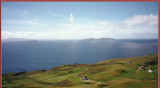
Marks the South entrance of the Kenmare river,  a most picturesque bay (despite its name), which offers a number of safe and beautiful harbours such as Sneem and Kilmakilloge. Darryname at the Northern entrance of the bay (North of Abbey Island) is also a beautiful and safe anchorage ...
3 Jan 17