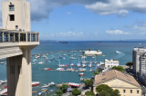
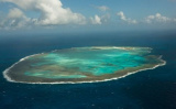
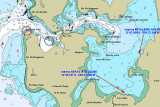
Towards the bottom of the Bay of All Saints, to starboard, there is a marked channel that leads to the bay of Aratu. It is from there that share the most contributes regatta Bahia, the place of arrival is Maragogipe, in August, in honor of Saint Bartholomew, the saint patron ...
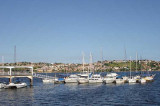
A friendly marina in the sheltered Itapajipe bay, N of Salvador city. All facilities, laundry, WiFi, chandlery, restaurant, small shop. Nearby
bus into the city. Owner speaks English and French and is most helpful.
A good place to leave the boat. At LW 1.4m in the approach channel.
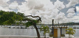
Bahia Marina offers customers and users complete infrastructure. Consists of:Bowl berth of 176,000 m2;400 wet empty marina spaces on aluminum floating piers, with access control equipped with lampposts, all with electricity and water meters taken at each point to encourage rational ...
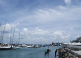
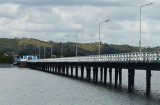
After rounding the fort of Paraguaçu (or Salamina), we arrive at "l'île du Français" (llha do Francês). At left, just after the island, is Maragojipe at the mouth of rio Guai. The city has a concrete pier more than 100 meters long. Maragojipe is located in a sheltered place, ...


 16
16


 Phone: (71} 3594-7373
")