Algar de Almadraba (C Valenciana)
5.7nm
122°
23 May 12
Jojo
| Latitude | Longitude | |
| DMS | --- | --- |
| DM | --- | --- |
| DD | --- | --- |

 Canal 9


 voile et windsurf school
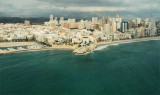
 Le club nautique représente l’un des principaux points d'intérêt d'une
commune qui marque la frontière entre Valencia et Alicante.
Le club nautique représente l’un des principaux points d'intérêt d'une
commune qui marque la frontière entre Valencia et Alicante.")
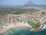
") Surf on Oliva beach
Surf on Oliva beachEbook | Espagne Est - East Spain
|