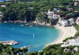
Cala de Tamariu

Cala de Tamariu

To precisely geolocate this site. Update if necessary.

Localisation

Cala de Tamariu
LatitudeLongitude
DMS------
DM------
DD------

Characteristics

Mooring
Sand
Beach
Sand
Diving

Description

This bay is lined with a nice beach (nude beach) with two smaller creeks that are open to both sides.

South, Cala Marquesa, with a small pier, and north, Aiguadolça, prepared with a rock as a platform for swimmers.

There is also an exit point for those who love diving and looking for the Faraió Aigua Gelida, two islands that emerge in solitary with funds greatly appreciated.
2012/07/5
Update
Jojo
Cette baie est bordée d'une plage agréable (plage nudiste) avec deux calanques plus petites qui sont ouvertes aux deux côtés.


Au sud, Cala Marquesa, avec un petit embarcadère, et au nord, Aiguadolça, avec une roche préparée comme plate-forme pour baigneurs.

Il y a aussi un point de sortie pour ceux qui aiment le plongée sous-marine et qui cherchent le Faraió d'Aigua Gèlida, deux îlots qui émergent en solitaires avec des fonds très appréciés.
2012/07/5
Update
Jojo
Cala de Tamariu
2012-07-05
Update
Jojo
Cala de Tamariu
2012-07-05
Update
Jojo
Ebook

Espagne Est - East Spain

  • 235 sites
  • 414 photos
  • publication date: 7 Jul 2023
  • .pdf file size: 180 Mb
Share your comments or photos on "Cala de Tamariu"

Sites around Cala de Tamariu

Flying distances - Direct line

Cala Pedrosa

0.5nm
185°
Anchorage by good weather, during the day.
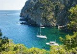
The cove is open to winds from E to S.Beware entering the cove, at E, shoals Sa Galera covered with 0,9 m of water.Anchor by 5 to 10 m. 
29 Jun 12
Jojo

Cala de Llafranc

1.6nm
192°
Located between Punta d'en Planch and Cabo San Sebastian, the small Llafranc cove is bordered by a beautiful sandy beach and offers on its E side the  Llafranc yacht club.
29 Jun 12
Jojo

Aiguablava

1.1nm
19°
Remarquable mouillage avec l'hôtel perché au dessus.Très fréquenté pendant l'été, je n'ai pas pu jeter mon ancre en août 2013, je suis allé à Sa Tuna, un peu plus haut, où il y avait aussi beaucoup de bateaux.
21 Apr 14
Atb

Cabo San Sebastian (Palafrugell)

1.2nm
192°
San Sebastian cape is a a high and steep promontory, reddish in color.
A light is shown, tower 12m high at an altitude of 155 m  
29 Jun 12
Jojo

Puerto Deportivo de Llafranc (Palafrugell)

1.5nm
200°
Llafranc is characterized by the presence of Sant Sebastian cape, who sits on the rocky cliffs that protect the marina. We can see the old watchtower which dates from 1445, the hermitage of Sant Sebastian and the lighthouse of the same name, which it, dates 1857.
Port protects ...
29 Jun 12
Jojo

Los Ullastres (Llafranc)

1.9nm
188°
Los Ullastres is a group of 3 rocky shoals that lies about 0,5 NM S of San Sebastian cape. It has a least depth of 7,1 m.
29 Jun 12
Jojo