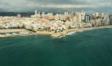
Algar de Almadraba (C Valenciana)
15nm
356°
23 May 12
Jojo
| Latitude | Longitude | |
| DMS | --- | --- |
| DM | --- | --- |
| DD | --- | --- |

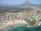
 Toix cape closes the Altea bay and marks the beginning of the cove of Calpe.
 Le cap de Toix ferme la baie d'Altea et marque le début de l'anse de Calpe.
Les abords du cap sont clairs.
")
Ebook | Espagne Est - East Spain
|