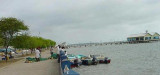
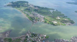
This interesting, friendly town is on the border with Ecuador. It sits
on an island connected to the mainland by a causeway. Many of the houses
in the area are built on stilts over the water.
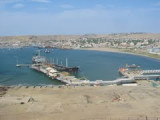
Tumaco is a military controlled port. You must call Guardacosta on VHF channel 16 ...
Tumaco, petite ville insulaire, centre de ravitaillement régional. Important trafic de pirogues, seul moyen de transport local.Tumaco est relié par route à la Colombie; la ville dispose d'un aéroport desservi chaque jour par un DC 3; c'esdt aussi la base d'hélicos utilisés ...


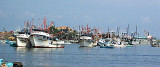
 Small port protected by a breakwater.
 Petit port protégé par une digue.