
Puerto Barquito de Chanaral (Atacama N Chile)
1.3nm
92°
29 Dec 12
Joëlle
| Latitude | Longitude | |
| DMS | --- | --- |
| DM | --- | --- |
| DD | --- | --- |

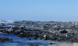
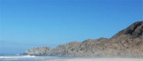
 The wide Chanaral de Las Animas bay lies from N to Punta Achurra and S to Punta Las Animas.
A long white sandy beach borders the bay shore that is exposed and open at the surf.
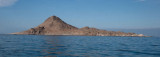
On the S side of the bay, hills rise abruptly from the sea forming an excellent shelter from S winds.
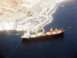
Chanaral harbour is SE of the bay.
The prevailing winds blow from the S and SW and are quite strong, particularly during January and February. Storms from the W and NW may occur during May and June, and may interrupt all work in the harbor for short periods.
Easterly winds, which generally blow at night, create a moderately-heavy sea in the bay.
Fogs are most frequent during the months from April to August, but may occur in other months also.
When easterly winds off the land are blowing, a current is created which sets W along the S shore of the bay.
The mean tidal rise is 0.9m, while the spring rise is 1.1m.
")
 La large baie Chanaral de las Animas s'étend de punta Achurra au N, à Punta Las Animas au S.
Une longue plage de sable blanc borde le rivage de la baie qui est exposée et ouverte à la houle.
Sur le côté S de la baie, les collines qui s'élèvent abruptement de la mer forment un bon abri des vents du S.
Le port de Chanaral se trouve au SE de la baie.
Le vent dominant souffle du S et du SW, il est souvent fort, notamment pendant les mois de janvier et de février.
Les tempêtes venant de l'W et du NW peuvent survenir pendant les mois de mai et juin et peuvent interrompre tout travail dans le port pendant de courtes périodes.
Les vents d'E, qui soufflent généralement la nuit, génèrent une mer modérément forte dans la baie.
Les brouillards sont plus fréquents durant les mois d'avril à août, mais peuvent apparaître aussi dans d'autres mois.
Quand les vents d'E venant de la terre soufflent, un courant se crée venant de l'W le long de la rive S de la baie.
La hausse moyenne des marées est de 0,9 m, tandis que la hausse de printemps est de 1,1 m.
Ebook | Chile
|