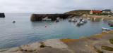
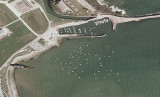
Port du Cap Levi, a small drying harbor, lies 0.5 mile S of the light. It is used by local fishing boats and yachts. An area of rocky shoals extends up to about 2 miles N of Cap Levi and is marked by a lighted buoy. This area is steep-to and the sea breaks on it in rough weather. ...
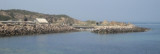
Le Becquet, situated 1 mile E of Cherbourg, is a small drying harbor. It is used by local fishing vessels and pleasure craft. A lighted range indicates the approach. Buoys (special) are moored about 0.4 mile and 2.3 miles N of this harbor. Le Grunes de Bretteville, a group of rocky ...
Port fermé par deux digues formant une passe de 50 mètres de large.
La digue occidentale de fermeture de 320 mètres qui se termine par un
musoir de 10 mètres de diamètre, prolonge l'enrochement du terre-plein
des Mielles. La digue orientale de 200 mètres et son musoir de ...
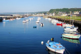
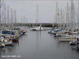
The port of Cherbourg is both a naval and a commercial port. It is an important port of call for passenger vessels in the transatlantic service. The outer roadstead provides a deep and well-sheltered anchorage. There are also extensive facilities for fishing vessels and pleasure craft.The ...