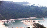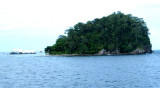

Pulau Segantang (Langkawi) (Malaysia)
7.1nm
258°
There are depths of 29.3m close to its N and E sides and 34.7m about 2 miles SW.
A Marine Park, with a radius of ...
19 Dec 11
Jojo
| Latitude | Longitude | |
| DMS | --- | --- |
| DM | --- | --- |
| DD | --- | --- |


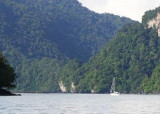
 Pulau Paya lies 6.5 miles E from Pulau Segantang, 88m high, is densely wooded and steepto, except for part of the NE side.
The Pulau Paya Marine Park has been established and special regulations may apply.
Pulau Lembu, 73m high, lies 0.5 mile NE of Pulau Paya. A rock awash lies about 0.1 mile to the N.
In the channel between these two islands lies Pulau Kacha, a rock, 26m high. Near the islands of Pulau Paya and Pulau Lembu there are, with the exceptions mentioned, depths of 23.8 to 29.3m within 0.5 mile of the islands.
 (Malaysia)")
 (Malaysia)")
Ebook | Andaman sea
|